Siltation and Coastal Erosion at Shoreline Harbours
1. Introduction
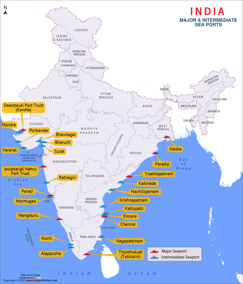
The harbours along east coast of India viz., Tuticorin, Chennai, Ennore, Krishnapatnam, Gangavaram, Visakhapatnam and Paradip come under shoreline harbours except the Kolkata and Haldia harbours which are river channel harbours. Whereas the harbours along west coast of India are classified as channel harbours in tidal estuaries. Location of harbours along Indian coastline can be seen in Fig. 1. Depending upon the classification of the harbours, the problems of siltation and maintenance of the channels are quite different. In the case of shoreline harbours the shoaling effects are generally in the immediate vicinity of the harbour where manmade structures are erected. The sedimentation problem of harbours in tidal estuaries varies from one tidal inlet to another and shoaling can occur right from the entrance of the estuary, although the harbour might be at a remote site up the estuary. In this paper the siltation problems encountered by the shoreline harbours are discussed. The objective of this research is to estimate the sediment transport rates using suitable empirical relations and correlate the same with maintenance dredging records so as to arrive a meaningful solution for the siltation problem faced by shoreline harbours. The effectiveness of the erosion control measures has been discussed. The appropriate and beneficial disposal of dredged material is a major problem for port authorities in India. The issue of current dredged material disposal practices is critically examined based on a scientific understanding of the related processes.
2. Siltation problem at shoreline harbours
One of the major problems encountered by the shoreline harbours along east coast of India is siltation in the form of littoral drift. In fact, the littoral drift is one of the largest on the world coastlines. For effective monitoring of the port approach channel and harbour basin, the rates of siltation due to littoral drift should be known.The monthly values of wave induced sediment transport quantities evaluated using wave energy flux method (SPM: CERC, 1977) at shoreline harbours of Chennai, Visakhapatnam and Paradip are depicted . The sediment movement along the north is taken as positive and shown upward in the figure whereas the southerly sediment movement is taken as negative and shown down ward in the same figure. The direction of sediment movement is from south to north during the period March to October when south west winds prevail over Bay of Bengal and the wave directions are predominantly from south and southeast along east coast of India where Chennai, Visakhapatnam and Paradip harbours are located. During north east monsoon period from November to February when wave directions are between northeast and east, the direction of sediment movement get reverses along east coast of India, that is, north to south.
The littoral drift quantities are large from May to August for all the three port locations viz., Chennai, Visakhapatnam and Paradip, due to heavy breakers along east coast associated with southwest monsoon. The northerly littoral drift from March to October is by far the most dominant at the shoreline harbours located along this coast. The rates of northerly sediment movement (littoral drift) are generally high at Paradip harbour when compared to Chennai and Visakhapatnam harbours. However, the rates of southerly littoral drift are high at Chennai harbour when compared to Visakhapatnam and Paradip harbours. As the Chennai harbour lacks natural protection and is exposed to strong swell from east during cyclone period from October to December causes large quantity of sediment movement towards south. The history of the Chennai harbour had also shown that the original entrance of the harbour from east was closed in 1911 and moved to north to protect the harbour from violent storms and associated siltation during north east monsoon (Johnson, 1957). The particular orientation of coast at Chennai and bottom topography perhaps amplifies the wave energy in the near shore zone particularly during cyclone period when long waves are generated. This is also one of the reasons that the Ennore port planners and engineers have provided long north and east breakwater of length 3080 m to protect the harbour from strong swell during north east monsoon season when the coast is exposed to frequent cyclones. The Ennore port which is located just 24 km north of Chennai port has similar site conditions as that of Chennai.
3. Maintenance Dredging;
The maintenance dredging is one of the serious problems encountered by the ports in India. The maintenance of harbour entrances is an expensive item in maritime administration. It would be helpful if some suggestion could be made for planning the future harbours or on improving the design of the existing harbours based on past lessons learned. The predictions on sediment transport rates and its relation to the dredging activities on possible lines of research would definitely throw light on maintenance of the harbour channels to some extent. The quantities of the dredging for various important ports in India are furnished in table 1. From the table 1 it is clear that the dredging is an annual maintenance problem encountered by various ports in India. The dredging quantities vary from port to port depending upon its location and draft required to be maintained. On an average about 50 million cubic meters per year of dredging quantity is involved for all the major ports for maintenance of channels. Hence, huge amounts are incurred by the port trusts for dredging and disposal of dredged material. Therefore, planning of maintenance dredging is an important activity of the Port Trust.
4. Disposal of Dredged Spoil;
The maintenance dredging material at shoreline harbours is partly utilized for direct nourishment of the down drift shoreline and partly dumped offshore at a short distance by hopper dredger on the assumption that the material would be moved onshore by wave action. Hence, the dumping grounds at shoreline harbours along east coast of India are normally located offshore north of the approach channel so that the dredged material would not move towards the channel during persistent south west monsoon season. The direct nourishment of the shoreline is normally done through pumping of the dredged sand by floating pipelines or by dispersal of sand along the coast by rainbow technique as shown in Fig 4. The selection of dumping grounds is a location specific and depends upon the near shore circulation phenomena and hydrodynamic characteristics of the sea.
The maintenance dredging quantities used for direct nourishment of down drift coastline and hoppered offshore at Visakhapatnam and Paradip ports from the available records have been examined to study the effectiveness of operations. On an average about 0.2 to 0.3 million cubic meters of sand used to pump on the down drift shoreline at Visakhapatnam port whereas about 0.5 to 0.6 million cubic meters of sand pumping takes place along eroded coastline of Paradip port. The balance quantity from maintenance dredging is used to dump at the earmarked offshore disposal grounds. From the estimates of littoral drift it is known that the net drift blocked by the southern breakwaters of Visakhapatnam and Paradip port are 0.55 and 1.68 million cubic meters per year respectively. It means that that the quantities pumped for nourishment of eroded beaches are not adequate to protect. As a result the down drift coastline experiences severe erosion as observed recently along Visakhapatnam coast

Coastal erosion at north of Visakhapatnamm port in January, 2015
5. Conclusions ;
Along east coast of India vast quantities of sand move in the near shore zone due to the action of waves and currents and cause siltation problem at shoreline harbours. The direction of littoral drift is from south to north during the period March to October when south west monsoon waves prevail over the Bay of Bengal and reverses its direction from north to south during north east monsoon season. Computations based on energy flux method give a northerly littoral drift of about 1.51, 0.84 and 1.92 million cubic meters per year and southerly littoral drift of about 1.05, 0.29 and 0.24 million cubic meters per year resulting in net sand movement of about 0.46, 0.55 and 1.68 million cubic meters per year towards north at shoreline harbours Chennai, Visakhapatnam and Pardip respectively. The estimated littoral drift quantities were closely correlated with the recent maintenance dredging quantities of the ports under study with some minor deviations. The recent maintenance dredging quantities of the ports under study have shown that on an average about 0.76, 0.79 and 2.74 million cubic meters per year of sand was dredged out from the harbour channels of Chennai, Visakhapatnam and Paradip respectively. The actual dredging quantities are less when compared to the estimated gross littoral drift quantities for Chennai and Visakhapatnam harbous and more for Paradip harbour. It means that some of the gross littoral drift at Chennai and Visakhapatnam harbours is intercepted by the southern breakwaters, fallen into sand traps and bypassed the approach channels. Since the northerly littoral drift is by far the most dominant along east coast of India which is intercepted either by the southern breakwaters or by the dredged channels at shoreline harbours, the down drift shorelines are nearly starved of sand supply, resulting in severe erosion. The direct pumping of sand to nourish the down drift shoreline at Visakhapatnam appears to be satisfactory. The disposal of dredged material by hoper in offshore dumping grounds with an assumption to move material towards sand starved coastlines have proved futile at Visakhapatnam and Paradip coasts. Further the offshore dumping grounds have become wave convergence zones and aggravated the erosion phenomena. Construction of seawall to protect the eroded shoreline at Paradip port has worsened the situation. The movement of bottom contours of -3 m and -5m towards the eroded Paradip coastline has revealed that the toe of the seawall may get collapse and hence the situation is alarming.
1. Introduction
The harbours along east coast of India viz., Tuticorin, Chennai, Ennore, Krishnapatnam, Gangavaram, Visakhapatnam and Paradip come under shoreline harbours except the Kolkata and Haldia harbours which are river channel harbours. Whereas the harbours along west coast of India are classified as channel harbours in tidal estuaries. Location of harbours along Indian coastline can be seen in Fig. 1. Depending upon the classification of the harbours, the problems of siltation and maintenance of the channels are quite different. In the case of shoreline harbours the shoaling effects are generally in the immediate vicinity of the harbour where manmade structures are erected. The sedimentation problem of harbours in tidal estuaries varies from one tidal inlet to another and shoaling can occur right from the entrance of the estuary, although the harbour might be at a remote site up the estuary. In this paper the siltation problems encountered by the shoreline harbours are discussed. The objective of this research is to estimate the sediment transport rates using suitable empirical relations and correlate the same with maintenance dredging records so as to arrive a meaningful solution for the siltation problem faced by shoreline harbours. The effectiveness of the erosion control measures has been discussed. The appropriate and beneficial disposal of dredged material is a major problem for port authorities in India. The issue of current dredged material disposal practices is critically examined based on a scientific understanding of the related processes.
2. Siltation problem at shoreline harbours
One of the major problems encountered by the shoreline harbours along east coast of India is siltation in the form of littoral drift. In fact, the littoral drift is one of the largest on the world coastlines. For effective monitoring of the port approach channel and harbour basin, the rates of siltation due to littoral drift should be known.The monthly values of wave induced sediment transport quantities evaluated using wave energy flux method (SPM: CERC, 1977) at shoreline harbours of Chennai, Visakhapatnam and Paradip are depicted . The sediment movement along the north is taken as positive and shown upward in the figure whereas the southerly sediment movement is taken as negative and shown down ward in the same figure. The direction of sediment movement is from south to north during the period March to October when south west winds prevail over Bay of Bengal and the wave directions are predominantly from south and southeast along east coast of India where Chennai, Visakhapatnam and Paradip harbours are located. During north east monsoon period from November to February when wave directions are between northeast and east, the direction of sediment movement get reverses along east coast of India, that is, north to south.
The littoral drift quantities are large from May to August for all the three port locations viz., Chennai, Visakhapatnam and Paradip, due to heavy breakers along east coast associated with southwest monsoon. The northerly littoral drift from March to October is by far the most dominant at the shoreline harbours located along this coast. The rates of northerly sediment movement (littoral drift) are generally high at Paradip harbour when compared to Chennai and Visakhapatnam harbours. However, the rates of southerly littoral drift are high at Chennai harbour when compared to Visakhapatnam and Paradip harbours. As the Chennai harbour lacks natural protection and is exposed to strong swell from east during cyclone period from October to December causes large quantity of sediment movement towards south. The history of the Chennai harbour had also shown that the original entrance of the harbour from east was closed in 1911 and moved to north to protect the harbour from violent storms and associated siltation during north east monsoon (Johnson, 1957). The particular orientation of coast at Chennai and bottom topography perhaps amplifies the wave energy in the near shore zone particularly during cyclone period when long waves are generated. This is also one of the reasons that the Ennore port planners and engineers have provided long north and east breakwater of length 3080 m to protect the harbour from strong swell during north east monsoon season when the coast is exposed to frequent cyclones. The Ennore port which is located just 24 km north of Chennai port has similar site conditions as that of Chennai.
3. Maintenance Dredging;
The maintenance dredging is one of the serious problems encountered by the ports in India. The maintenance of harbour entrances is an expensive item in maritime administration. It would be helpful if some suggestion could be made for planning the future harbours or on improving the design of the existing harbours based on past lessons learned. The predictions on sediment transport rates and its relation to the dredging activities on possible lines of research would definitely throw light on maintenance of the harbour channels to some extent. The quantities of the dredging for various important ports in India are furnished in table 1. From the table 1 it is clear that the dredging is an annual maintenance problem encountered by various ports in India. The dredging quantities vary from port to port depending upon its location and draft required to be maintained. On an average about 50 million cubic meters per year of dredging quantity is involved for all the major ports for maintenance of channels. Hence, huge amounts are incurred by the port trusts for dredging and disposal of dredged material. Therefore, planning of maintenance dredging is an important activity of the Port Trust.
4. Disposal of Dredged Spoil;
The maintenance dredging material at shoreline harbours is partly utilized for direct nourishment of the down drift shoreline and partly dumped offshore at a short distance by hopper dredger on the assumption that the material would be moved onshore by wave action. Hence, the dumping grounds at shoreline harbours along east coast of India are normally located offshore north of the approach channel so that the dredged material would not move towards the channel during persistent south west monsoon season. The direct nourishment of the shoreline is normally done through pumping of the dredged sand by floating pipelines or by dispersal of sand along the coast by rainbow technique as shown in Fig 4. The selection of dumping grounds is a location specific and depends upon the near shore circulation phenomena and hydrodynamic characteristics of the sea.
The maintenance dredging quantities used for direct nourishment of down drift coastline and hoppered offshore at Visakhapatnam and Paradip ports from the available records have been examined to study the effectiveness of operations. On an average about 0.2 to 0.3 million cubic meters of sand used to pump on the down drift shoreline at Visakhapatnam port whereas about 0.5 to 0.6 million cubic meters of sand pumping takes place along eroded coastline of Paradip port. The balance quantity from maintenance dredging is used to dump at the earmarked offshore disposal grounds. From the estimates of littoral drift it is known that the net drift blocked by the southern breakwaters of Visakhapatnam and Paradip port are 0.55 and 1.68 million cubic meters per year respectively. It means that that the quantities pumped for nourishment of eroded beaches are not adequate to protect. As a result the down drift coastline experiences severe erosion as observed recently along Visakhapatnam coast
Coastal erosion at north of Visakhapatnamm port in January, 2015
5. Conclusions ;
Along east coast of India vast quantities of sand move in the near shore zone due to the action of waves and currents and cause siltation problem at shoreline harbours. The direction of littoral drift is from south to north during the period March to October when south west monsoon waves prevail over the Bay of Bengal and reverses its direction from north to south during north east monsoon season. Computations based on energy flux method give a northerly littoral drift of about 1.51, 0.84 and 1.92 million cubic meters per year and southerly littoral drift of about 1.05, 0.29 and 0.24 million cubic meters per year resulting in net sand movement of about 0.46, 0.55 and 1.68 million cubic meters per year towards north at shoreline harbours Chennai, Visakhapatnam and Pardip respectively. The estimated littoral drift quantities were closely correlated with the recent maintenance dredging quantities of the ports under study with some minor deviations. The recent maintenance dredging quantities of the ports under study have shown that on an average about 0.76, 0.79 and 2.74 million cubic meters per year of sand was dredged out from the harbour channels of Chennai, Visakhapatnam and Paradip respectively. The actual dredging quantities are less when compared to the estimated gross littoral drift quantities for Chennai and Visakhapatnam harbous and more for Paradip harbour. It means that some of the gross littoral drift at Chennai and Visakhapatnam harbours is intercepted by the southern breakwaters, fallen into sand traps and bypassed the approach channels. Since the northerly littoral drift is by far the most dominant along east coast of India which is intercepted either by the southern breakwaters or by the dredged channels at shoreline harbours, the down drift shorelines are nearly starved of sand supply, resulting in severe erosion. The direct pumping of sand to nourish the down drift shoreline at Visakhapatnam appears to be satisfactory. The disposal of dredged material by hoper in offshore dumping grounds with an assumption to move material towards sand starved coastlines have proved futile at Visakhapatnam and Paradip coasts. Further the offshore dumping grounds have become wave convergence zones and aggravated the erosion phenomena. Construction of seawall to protect the eroded shoreline at Paradip port has worsened the situation. The movement of bottom contours of -3 m and -5m towards the eroded Paradip coastline has revealed that the toe of the seawall may get collapse and hence the situation is alarming.


No comments:
Post a Comment